Canal system monitoring
300km Kerian canal infrastructure mapping — Malaysia Book of Records achievement
The challenge
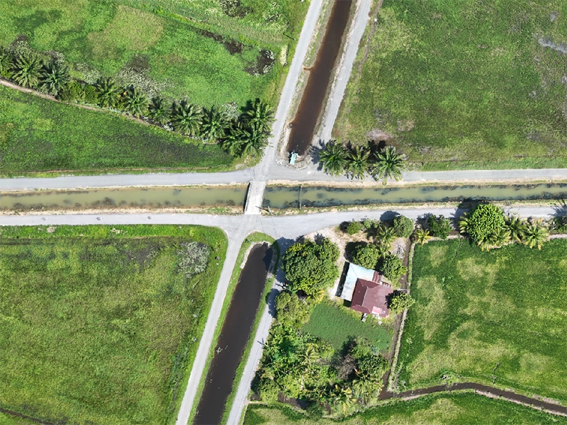
IADA Kerian required comprehensive mapping and monitoring of their entire 300-kilometre canal infrastructure system — one of Malaysia's largest irrigation networks serving the Kerian rice granary area in Perak. Traditional boat-based and ground-level surveying would have taken months, cost significantly more, and risked disrupting the sensitive freshwater ecosystem that thousands of farmers depend on.
The project needed to capture detailed channel conditions, structural integrity data, sedimentation levels, and vegetation encroachment across the entire network — while preserving the ecological balance of this critical agricultural waterway.
The solution
Dronify developed a zero-impact monitoring methodology specifically for this environmentally sensitive project. Advanced flight planning ensured wildlife protection and regulatory compliance throughout the 300km survey corridor. Our aerial approach eliminated the need for boat access entirely, preserving water quality and minimising disturbance to the aquatic ecosystem.
The survey included a 31km continuous river section that achieved Malaysia Book of Records certification — the longest continuous aerial river survey in the country. High-resolution orthomosaics, detailed canal condition reports, and 3D modelling of critical infrastructure points were delivered within 5 days of fieldwork completion.
Results & impact
- RM 600,000 cost savings: Eliminated boat-based surveying costs, equipment rental, and extended field team deployment
- 5-day delivery: Complete infrastructure assessment delivered in under a week
- Malaysia Book of Records: 31km continuous river survey — certified national achievement
- Zero ecosystem disruption: No boat access, no water contamination, wildlife undisturbed
- 300km comprehensive coverage: Full canal network mapped for ongoing infrastructure management
- Regulatory compliance: All flight operations met CAAM requirements and environmental protection standards
Have a similar project?
Get a free project assessment for your canal, river, or infrastructure monitoring needs.