CAAM Certified · Malaysia Book of Records · 500+ Flights
Drone mapping that delivers certainty
Malaysia's premier drone mapping specialists delivering strategic competitive advantage through precision technology. Accelerate timelines, reduce costs, and eliminate survey-related risks.
Trusted by
Core capabilities
Minimize operational costs, eliminate safety risks, and accelerate project timelines through precision aerial data collection.


Market leadership & authority
Malaysia's trusted drone mapping specialists delivering proven results through industry-leading certifications, a proven portfolio, and enterprise-grade technology.
Industry certifications
Triple-certified operations ensuring regulatory compliance across Malaysia, Norway, and US jurisdictions.
Proven results
Malaysia Book of Records certification and 28 successful enterprise projects with consistent value delivery.
Industry expertise
Providing industry updates, technical insights, and professional guidance to the broader surveying community.
How it works
Professional drone mapping delivered in three clear steps: site capture, data processing, and ready-to-use deliverables in your preferred formats.

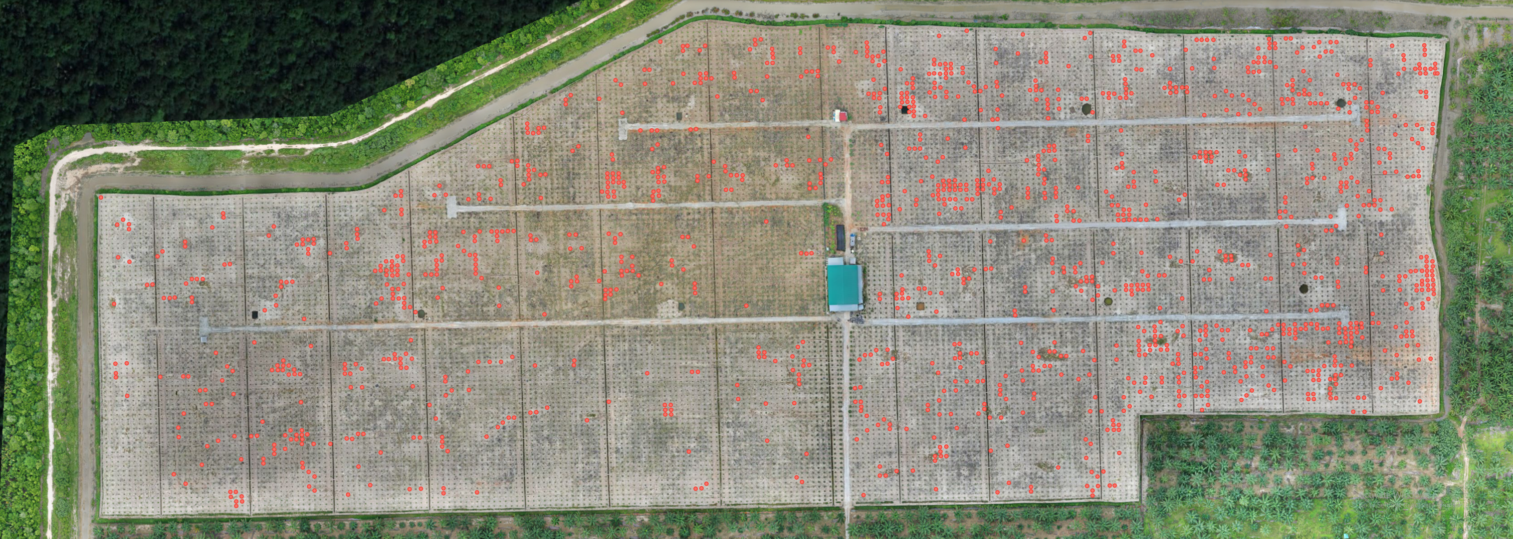
Capture
We collect comprehensive aerial data of your entire site using RTK/GPS positioning and survey-grade accuracy standards.
Process
We transform aerial imagery into precise maps and models using industry-leading algorithms and quality validation.
Deliver
You receive results in industry-standard formats compatible with your existing CAD, GIS, and project management systems.
Deliverables
Comprehensive mapping outputs in industry-standard formats for immediate integration into your workflow.
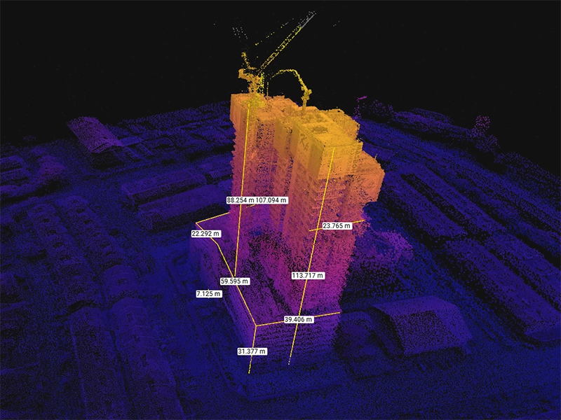
Point clouds
Dense 3D data in .las, .laz, .ply formats
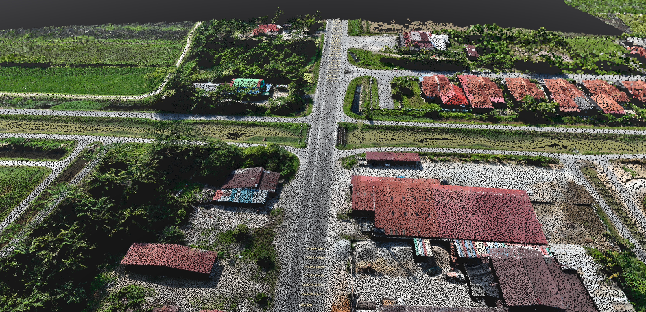
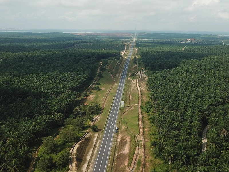
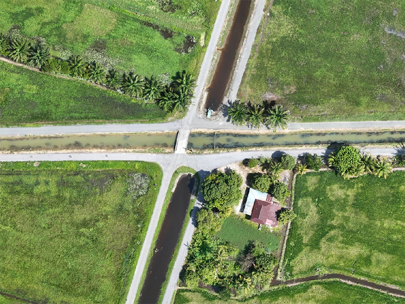
Orthomosaic maps
Georeferenced imagery at 1-5cm/pixel GSD
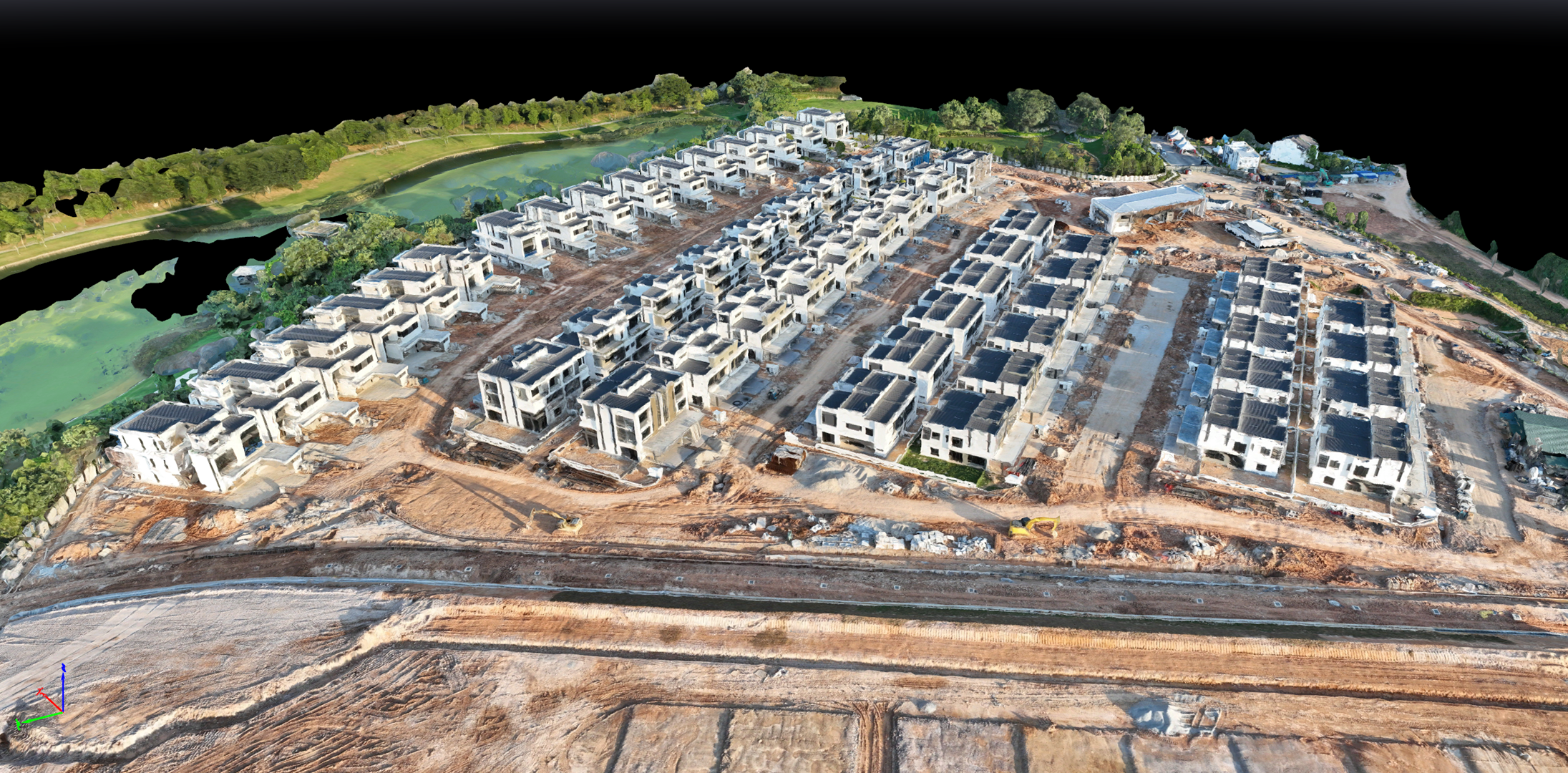
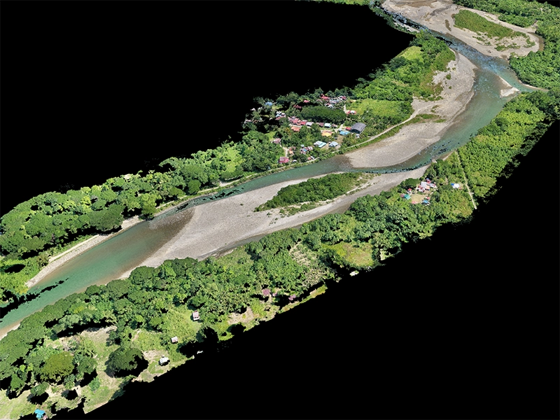
3D mesh
Photorealistic textured models in .obj, .fbx
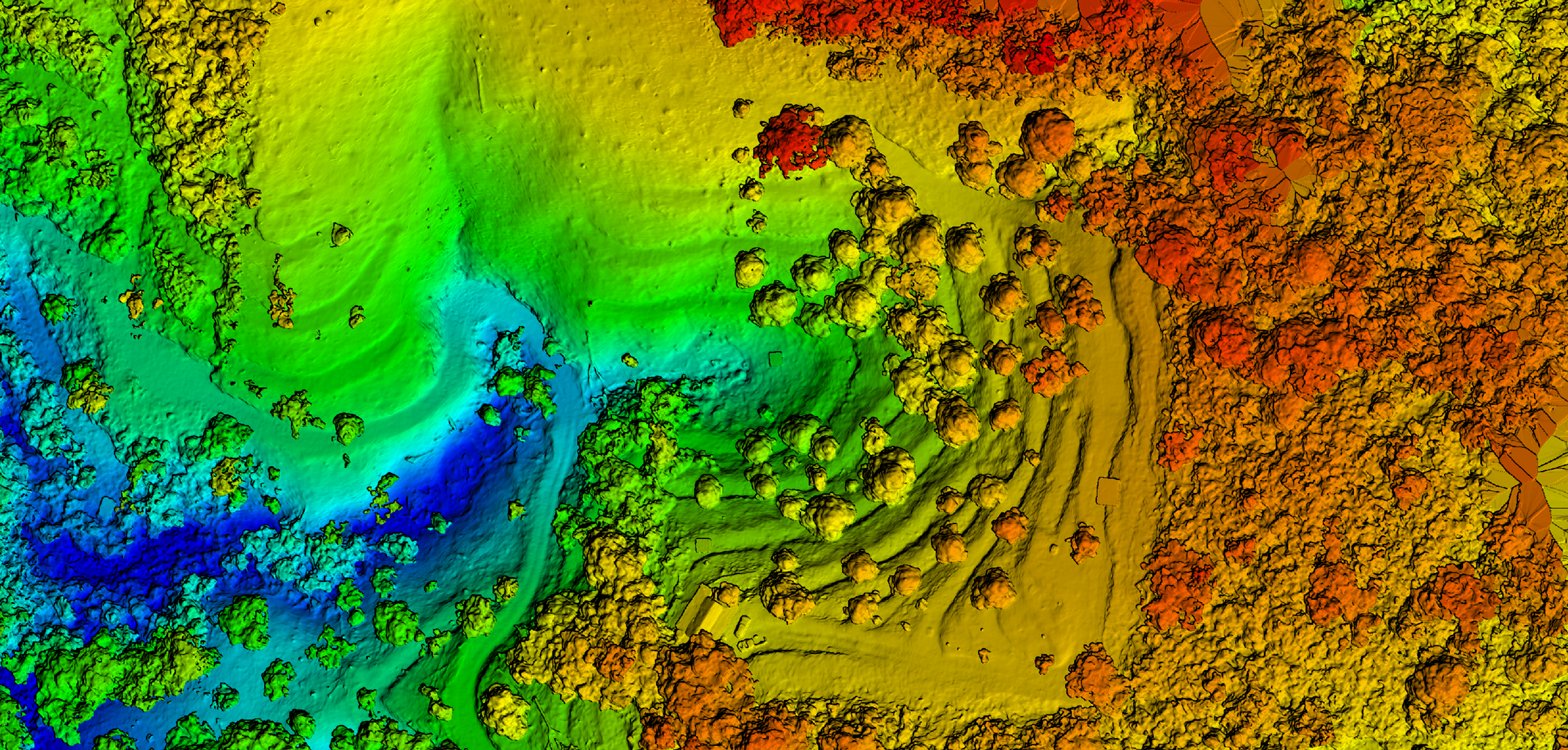
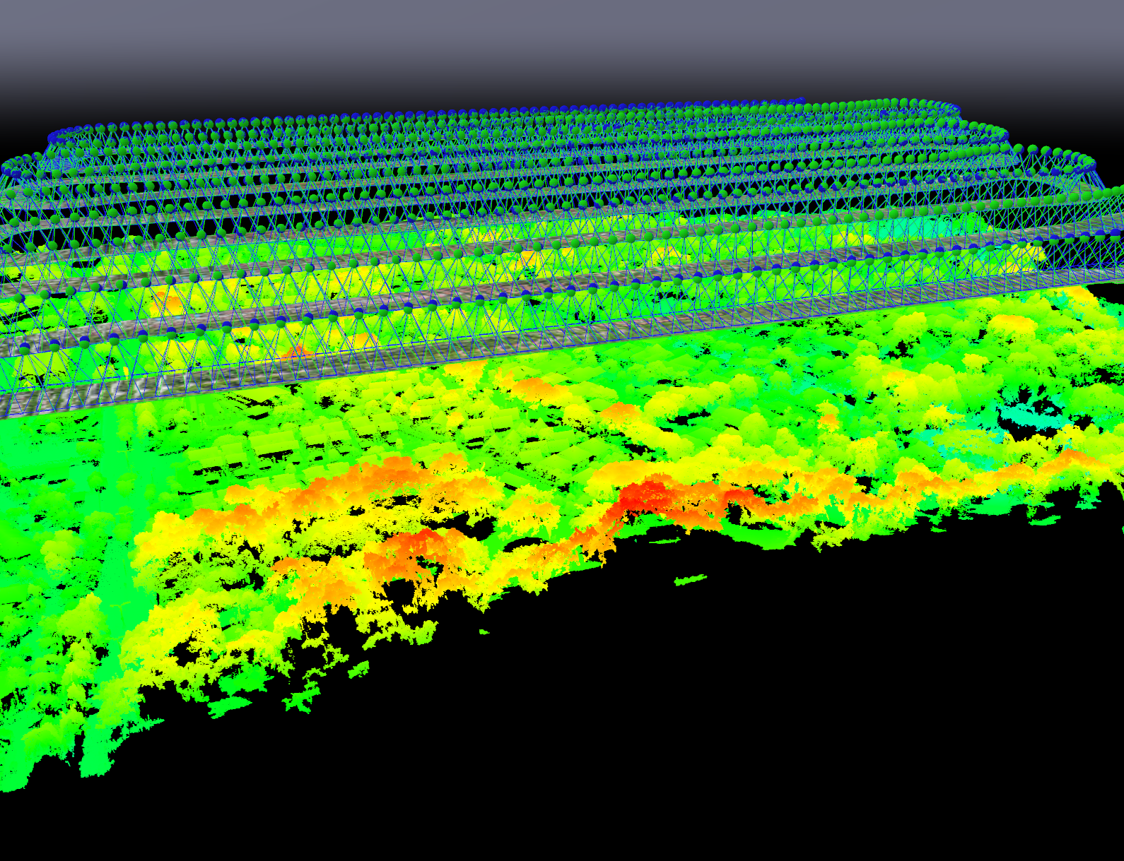
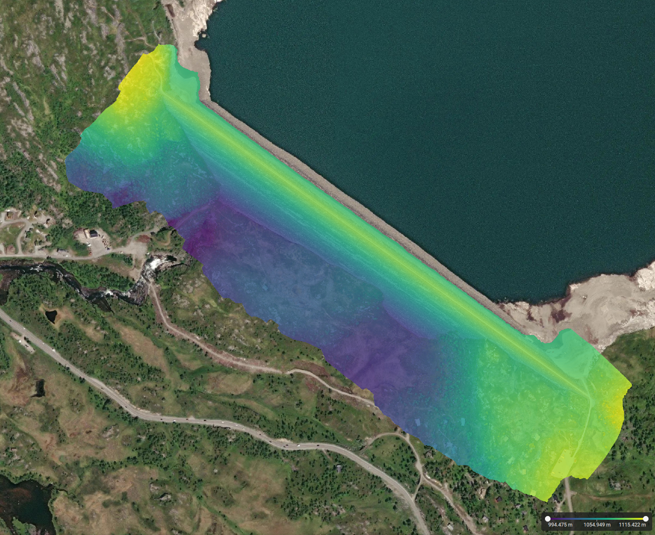
Elevation data
DSM/DTM for cut-fill and slope analysis
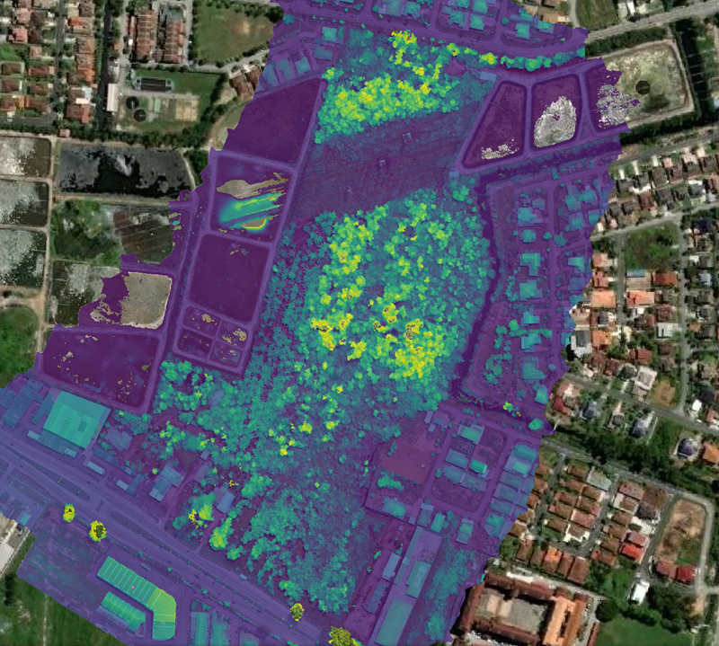
Map overlays
GIS-compatible .shp, .kml vector datasets
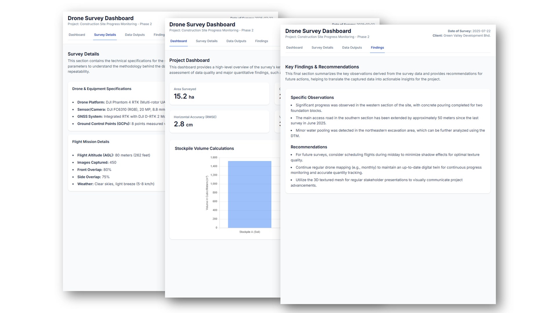
Progress reports
Timestamped documentation with metrics
Project portfolio
Proven business impact for Malaysia's leading enterprises. High-stakes projects demonstrating measurable ROI and competitive advantages delivered at scale.
Free project assessment
We review your project requirements and provide recommendations, cost estimates, and implementation plans. No-obligation consultation with our experts.
Free consultation · No obligation · 24h response
Direct contact
Connect with our team directly for immediate assistance, urgent projects, or detailed technical discussions.